Contaminated land strategy
Description of the Welwyn Hatfield area
4.1 Brief History
Situated in central Hertfordshire, the Borough of Welwyn Hatfield was created in 1974 following a review of local government in England & Wales. It is composed of the main towns of Welwyn Garden City and Hatfield, both New Towns, plus numerous smaller settlements.
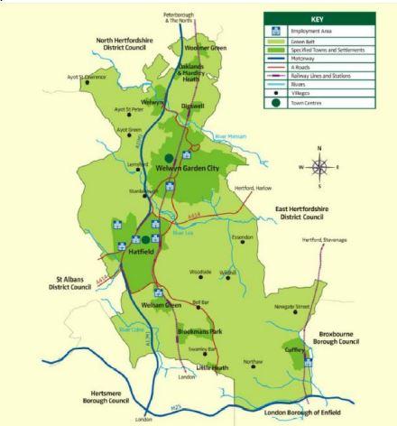
76.7% of the borough is designated as part of the Metropolitan Green Belt, which reflects the borough’s extensive countryside near to London.
The towns and villages that make up the borough have a rich cultural heritage, ranging from Roman times to the founding of Welwyn Garden City as the world’s second Garden City.
The southern area of the borough occupied by the majority of the Green Belt is dominated by farming, market gardening and seed growing nurseries from an economic activity perspective.
However, in the towns of Welwyn Garden City and Hatfield there has been a wide range of industrial activities. In the 1920s Shredded Wheat (subsequently Nabisco) established its factory in Welwyn Garden City. In the 1930s Murphy was employing 500 employees building radios in Welwyn Garden City before relocating to Ware in the 1960s. Other significant factories in the Garden City included Nivea present from the 1930s and American Norton Griding Wheels (1931 – 1982), Lincoln Electric and ICI had a chemical plant (plastics division) (1930s – 1950s), plus LeRoche and Smith Kline, Allied Bakeries, Knorr and Suchard.
Hatfield’s industry was dominated by DeHavilland which moved its aircraft manufacturing there in 1934 before becoming British Aerospace (BAE) later in the 20th Century. The aircraft manufacture industry in Hatfield ceased in 1993 when BAE sold the site for redevelopment for a business park and housing. The largest employer in Hatfield is currently the University of Hertfordshire and there is also a major education campus, the main campus of the Royal Veterinary College, located west of Brookmans Park.
4.2 Population Size and Area The 2021 census recorded the borough’s population to be 119,900, with the population of Hatfield being 41,265 and Welwyn Garden City’s being 49,600. The area of the Borough is 12,954 hectares.
4.3 Land owned by the Council The Council owns both land and buildings within the borough. The Council’s property management database records properties plus grass verges and amenity space. Therefore, it is accepted that the Council may own areas of land that may be contaminated. These will be considered under the Strategy in the same way as all other land.
4.4 Broad Geological and Hydrogeological Characteristics The northern half of the borough is underlain by a principal chalk aquifer, which is a significant drinking water resource. This is overlain by alluvial soils which can allow for rapid flow of water into water resources, leaving then relatively susceptible to pollution, but also areas of boulder clay that are less permeable. As well as being an important source of potable water supplies, there are 17 known private water supplies in addition to the public drinking water supplies managed by Affinity Water, the chalk aquifer provides base-flow to the area’s chalk streams. The southern half of the borough is underlain by various secondary aquifers within alluvial deposits that are also utilised for local water supplies, but there is also a belt of Lambeth Group clays and gravels and at the southern boundary a stretch of London Clay.
4.5 Broad Hydrological Characteristics The borough’s physical geography is defined by watercourses, predominantly running north-west to south-east, with the River Lea and River Mimram the most significant both flowing towards the Thames in East London. The Lea runs in a shallow valley separating Welwyn Garden City from Hatfield, whilst the Mimram runs in a deeper valley through Welwyn and separating Welwyn Garden City from Digswell. The Mimmshall Brook and River Colne drain the south-west corner of the borough and flow south-west through Watford to the Surrey.
4.6 Protected Locations The borough’s unique built environment and heritage includes the world’s second garden city and
- 10 conservation areas,
- 5 registered historic parks and gardens,
- 431 listed buildings and structures
- 73 areas of archaeological significance, 4 of which are scheduled ancient monuments (Coldharbour moat, Essendon – Linear earthwork, Perry Grove Welwyn – Dicket Mead Roman Villa, Welwyn – Lockleys Roman Villa, Welwyn)